Southern Nevada and Las Vegas: History in Maps
The historic map collection housed in the UNLV Libraries’ Division of Special Collection dates from the 17th century to the present, including significant collections concerning the exploration of the American West, the American Southwest, Nevada, and Southern Nevada. This collection contains the original published reports of the great 19th century U.S. government surveys of the West, as well as the series of maps and atlases by Fremont, Emory, Beckwith, Warren and Wheeler that accompanied the published accounts.
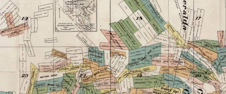
Special Collections also houses historic state highway, geological, and topographical maps, and USGS maps from the state of Nevada and bordering quadrangles in California and Arizona, as well as private collections created or annotated by individual geologists, surveyors and engineers. The map collection contains a comprehensive series of Las Vegas city street maps, maps produced by Clark County agencies and departments, the original U.S. Land Office survey maps of Clark County, copies of plats from the County Recorder’s Office, and plat and site plans created by the Union Pacific Railroad and later real estate developers.
The Digital Map Collection: Nevada, Las Vegas, and the Southwest
The maps selected for this digital project document the cartographic history and context of this region, telescoping in scale from the Western Hemisphere to the streets of Las Vegas. Maps were selected to highlight the collection, both in terms of individually important maps and in the breadth and variety of the collection.
These maps provide not only a history of the region through its changing political boundaries, but also a history of map-making and the development of the cartographic knowledge of this area. They also demonstrate the great variety of purposes of map making, as maps were, and are, created for a variety of purposes showing different kinds of features which provide different types of information.
Early maps were works of imagination or imperial ambition as nations sought to publish their claims to vast territories, even continents or hemispheres, by royal or papal edict, the planting of a flag, and the drawing of a map. As astronomical knowledge and instruments became more sophisticated, mapping became more accurate and scientific. Maps became legal documents and evidence of boundaries and property rights. Maps were used for advertising and promotion, planning and projections. They were the records of geological history, natural and human resources, environmental conditions and the engineering of the environment, through water resource management or highway construction. It is hoped that this project demonstrates what a critical historical resource maps are, and how important it is to preserve them.
The maps can be viewed using a variety of search strategies. For instance, placing "Mexico" and "Southwest" in the search box will retrieve maps focusing on this geographic region. Other suggested search strategies might be "western exploration, " "Southwest Territories," "railroads, " "Las Vegas," "mining," "Clark County," "Lincoln County," "water," "and "Hoover Dam," to name a few.
Related Digital Projects
University of Nevada, Las Vegas
Henderson District Public Library
University of Nevada, Reno